![Geolocation Satellite Imagery](Assets/dronza_images/map.jpg)
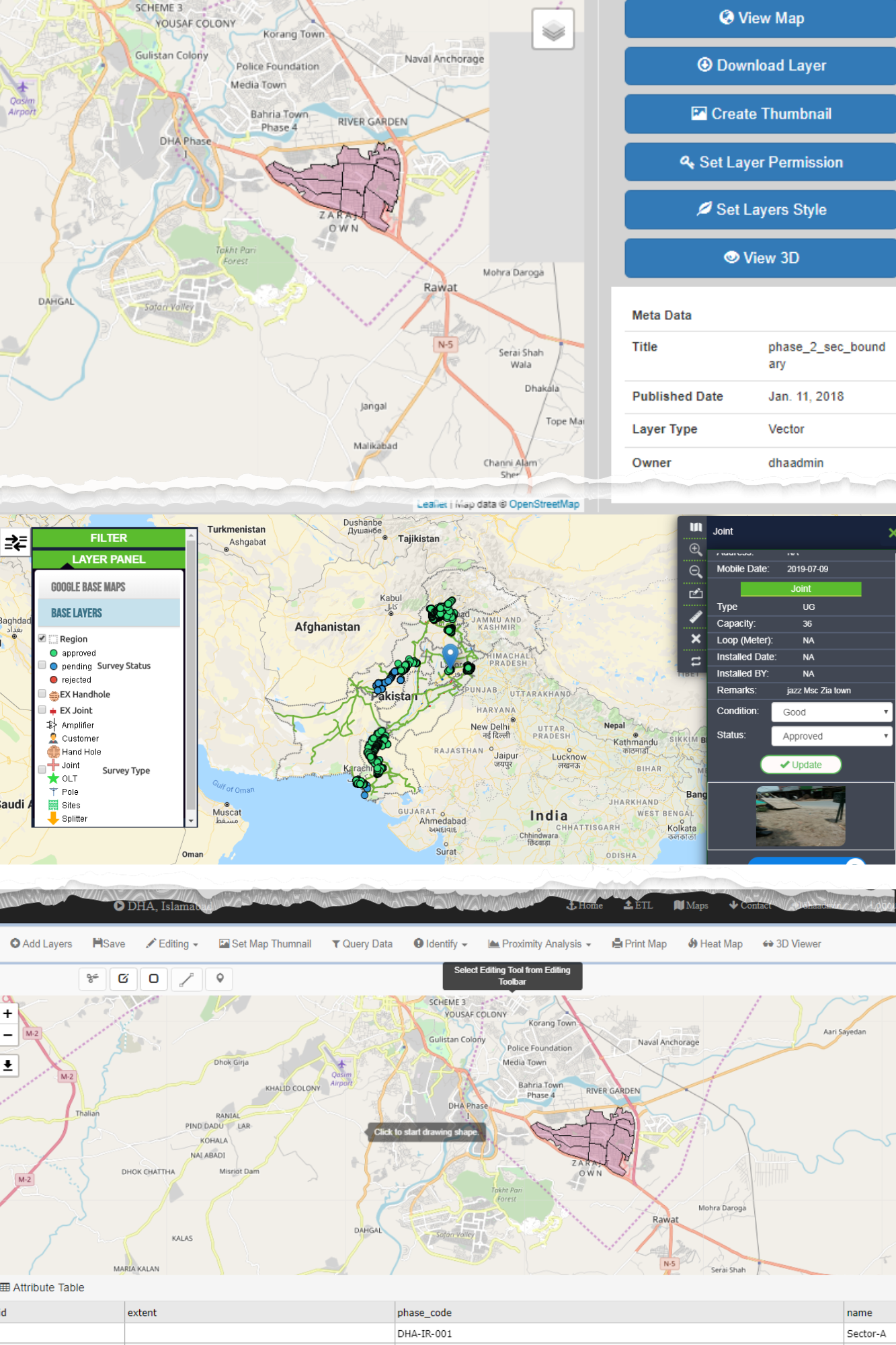
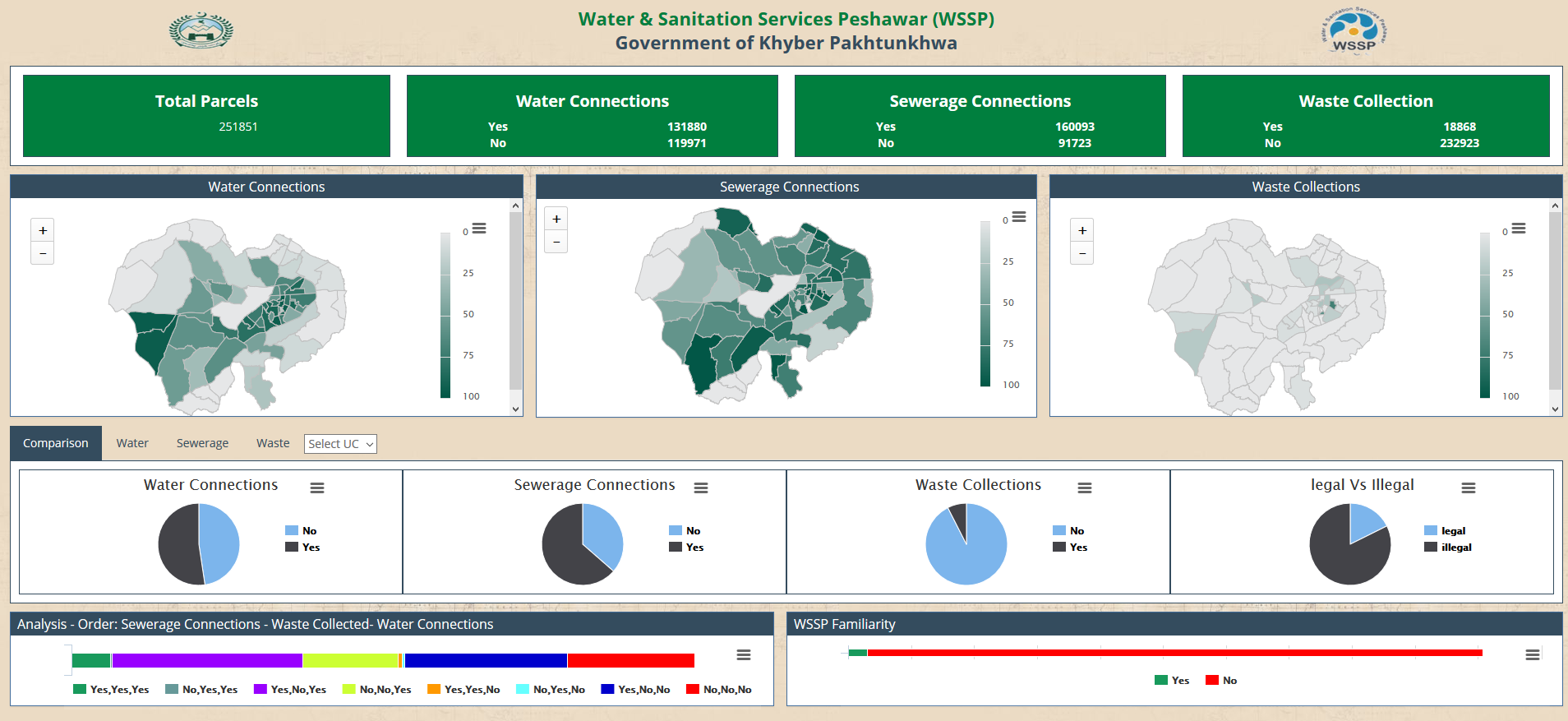
We offer a range of GIS based services mentioned below.
- Advanced GIS Mapping Solutions
- Custom Geospatial Application Development
- Geodatabase Design and Management
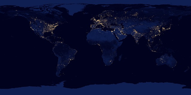
- Remote Sensing and Satellite Imagery Analysis
- GIS Integration Services
- Spatial Consulting and Training Expertise
- Location-based Decision Support Systems
![Geospatial Technology, Spatial Data](Assets/dronza_images/techteam-logo.png)
At TechTeam Pvt Limited we believe in harnessing the power of spatial intelligence to redefine how businesses navigate the world. Our commitment lies in delivering cutting-edge GIS mapping solutions tailored to your unique needs, unlocking the potential of comprehensive spatial analysis, and providing unparalleled insights through data visualization. Whether you're managing assets, analyzing trends, or planning for the future, TechTeam Pvt Limited empowers you to make informed decisions grounded in the geographic context. We specialize in custom geospatial application development, geodatabase design, remote sensing, and spatial consulting, guiding your organization towards spatial excellence.
At the heart of our mission is a dedication to transforming data into actionable insights. Our team of experts leverages state-of-the-art technologies to extract valuable information from spatial data, offering predictive modeling, spatial pattern recognition, and innovative solutions crafted to meet your specific challenges. With a focus on precision, innovation, and client success, TechTeam Pvt Limited is your trusted partner in navigating the complexities of GIS, shaping a future where spatial intelligence drives strategic decisions and optimizes business processes. Explore the possibilities with us, and let's embark on a journey where the spatial dimension becomes a realm of unlimited potential for your organization.
Visit our best video gallery
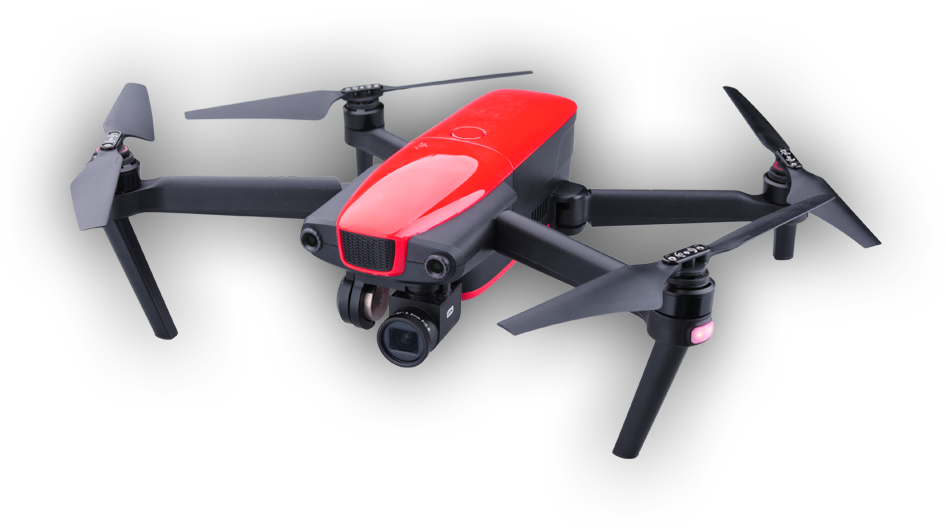
It’s amazing to think that a few years ago camera drones were little more than novelty toys for gadget-heads; now they’re a creative tool few photographers or filmmakers want to go without.
![Geographic Information System Maps development, Spatial Analysis, digitization](Assets/dronza_images/main-slider/slider3/slide1.jpg)
Basharat Iqbal
![GIS, Geographic Information System, Spatial Analysis, Mapping Services, Cartography, Geospatial Technology, Spatial Data, Satellite Imagery, Geolocation, Remote Sensing, Location Intelligence, GIS Solutions, Mapping Software, Geodatabase, Spatial Modeling, Geospatial Analytics, GIS Consulting, GPS Tracking, Geospatial Development, Geographic Information Science, Topographic Maps, GIS Applications,
Map Integration, Geo-tagging, GIS Mapping, Spatial Visualization](Assets/dronza_images/main-slider/slider3/slide1.jpg)
Dr Ather Ashraf
![GIS, Geographic Information System, Spatial Analysis, Mapping Services, Cartography, Geospatial Technology, Spatial Data, Satellite Imagery, Geolocation, Remote Sensing, Location Intelligence, GIS Solutions, Mapping Software, Geodatabase, Spatial Modeling, Geospatial Analytics, GIS Consulting, GPS Tracking, Geospatial Development, Geographic Information Science, Topographic Maps, GIS Applications,
Map Integration, Geo-tagging, GIS Mapping, Spatial Visualization](Assets/dronza_images/main-slider/slider3/slide1.jpg)
Shakir Abbas
![GIS, Geographic Information System, Spatial Analysis, Mapping Services, Cartography, Geospatial Technology, Spatial Data, Satellite Imagery, Geolocation, Remote Sensing, Location Intelligence, GIS Solutions, Mapping Software, Geodatabase, Spatial Modeling, Geospatial Analytics, GIS Consulting, GPS Tracking, Geospatial Development, Geographic Information Science, Topographic Maps, GIS Applications,
Map Integration, Geo-tagging, GIS Mapping, Spatial Visualization](Assets/dronza_images/main-slider/slider3/slide1.jpg)
Uzair Ul Hassan Shah
![GIS, Geographic Information System, Spatial Analysis, Mapping Services, Cartography, Geospatial Technology, Spatial Data, Satellite Imagery, Geolocation, Remote Sensing, Location Intelligence, GIS Solutions, Mapping Software, Geodatabase, Spatial Modeling, Geospatial Analytics, GIS Consulting, GPS Tracking, Geospatial Development, Geographic Information Science, Topographic Maps, GIS Applications,
Map Integration, Geo-tagging, GIS Mapping, Spatial Visualization](Assets/dronza_images/main-slider/slider3/slide1.jpg)
Ubaid Gul
![GIS, Geographic Information System, Spatial Analysis, Mapping Services, Cartography, Geospatial Technology,
Spatial Data, Satellite Imagery, Geolocation, Remote Sensing, Location Intelligence, GIS Solutions, Mapping Software, Geodatabase, Spatial Modeling, Geospatial Analytics, GIS Consulting, GPS Tracking, Geospatial Development, Geographic Information Science, Topographic Maps, GIS Applications, Map Integration, Geo-tagging, GIS Mapping, Spatial Visualization](Assets/dronza_images/main-slider/slider3/slide1.jpg)
Sohaib Hassan
![](Assets/dronza_images/main-slider/slider3/slide1.jpg)